Mobile positioning data (MPD) is the best dynamic source of information on the geographical distribution of the population
Understanding where people are at certain points in time can provide valuable input in various domains. With growing concerns about climate change-related disasters and pandemics, MPD can provide an input to national or regional planning and rescue services.
MPD enables seeing the actual population in an area, compared to official residents registered in a census. Because of its automated collection, MPD can show changes in time quicker than the less cost-effective traditional data collection methods.
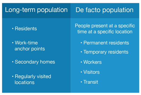
There are several unique pieces of information in MPD about short- and long-term population:
- the number of permanent residents in a specific municipality
- work-time anchor points
- other regularly visited locations (secondary homes, summer houses)
- and de facto population.
The main users of population statistics from mobile phone data are national statistical offices, ministries of regional planning, city governments and municipalities, and resource-planning departments of law enforcement and rescue services.
Explore the application of MPD-based population statistics in crisis and disaster management.
.png)
