For mobile positioning data (MPD), the main concerns are difficulty of access and data protection. The latest data protection laws see to that all mobile-based data used for statistics protects the privacy of people. Developments of recent years have shown that the benefits of the use of mobile data surpass the effect of the above-mentioned issues and an increasing number of countries are adopting mobile data. (This has been corroborated by the Eurostat-commissioned “Feasibility Study on the Use of Mobile Positioning Data for Tourism Statistics”[1].)
Mobility studies are a topic of deep interest for researchers with access to this dataset, and the tracing of urban movements was envisioned as one of the original uses for location data from cellphones (Ratti et al 2006). From that time onwards, several studies have been attempted, both in regional mobility (Järv et al 2012, Novak et al 2013) and urban mobility (Caceres et al 2007, Ahas et al 2010, Calabrese et al 2011, Iqbal et al 2014).
However, there are several issues with inferring mobility patterns from passive location data at the cell tower level and making use of this data for transportation research (Saluveer & Ahas 2014):
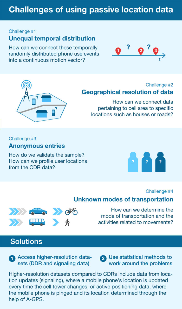
- Problem 1: Call detail records (CDR) data has unequal temporal distribution related to the frequency of phone use. How can we connect these temporally randomly distributed phone use events into a continuous motion vector?
- Problem 2: The geographical resolution of CDR data is usually within the accuracy of a network cell, the cross-section of which is usually between 200 and 10,000 metres. How can we connect data pertaining to cell area to specific locations such as houses or roads? How can we downscale intercellular movement into the level of streets, highways, settlements or landscapes?
- Problem 3: CDR data entries are usually anonymous, and we have little information about the subscribers How do we validate the sample? How can we profile user locations from the CDR data?
- Problem 4: The data are fragmented and anonymous. How can we determine the mode of transportation and the activities related to movements?
There are two ways to solve these problems: a) access higher-resolution datasets (DDR and signalling data), or b) use statistical methods to work around the problems. Different to CDRs, higher-resolution datasets include location updates (signalling data), which are updates in a mobile phone’s location every time the cell tower changes, or data from active positioning data, where the mobile phone is pinged and its location is determined with the help of A-GPS. Statistical methods that can be used to work around the problems have been outlined by Saluveer and Ahas (2014). Working with signalling data does not remove the need for employing statistical methods, but it makes the results less sensitive to statistical bias.
Positium has been working on this issue for a long time, both on CDRs and signalling data. We recommend any project to start with proper quality assurance of the input data – in order to design the methods for analysing the data, it is necessary to first have a clear understanding of the data. Only then can the feasibility of such data for mobility research be determined. A proper mobility study with MPD will also take into account the methods for statistically enhancing mobile positioning datasets, such as the ones developed by the University of Tartu in collaboration with Positium as outlined in Saluveer and Ahas (2014).
Globally, much has
been achieved thanks to information provided by mobile positioning data. Roads
have been built, the impact of various infrastructure investments has been calculated,
traffic control has been designed, public transportation networks have been amended
and, in effect, better decisions have been made thanks to MPD. If used to its
full effect, MPD can be a powerful and cost-effective solution for measuring
mobility.
Would you be interested in learning more about mobile big data and Positium? Let's talk about what mobile big data can do to help your organisation make decisions based on population mobility.
Reference articles
Caceres, N., Wideberg, J. P., & Benitez, F. G. (2007). Deriving origin destination data from a mobile phone network. IET Intelligent Transport Systems, 1(1), 15-26.
Calabrese, F., Di Lorenzo, G., Liu, L., & Ratti, C. (2011). Estimating origin-destination flows using mobile phone location data. IEEE Pervasive Computing, 10(4), 0036-44.
Çolak, S., Alexander, L. P., Alvim, B. G., Mehndiratta, S. R., & González, M. C. (2015). Analyzing cell phone location data for urban travel: current methods, limitations, and opportunities. Transportation Research Record: Journal of the Transportation Research Board, (2526), 126-135.
Iqbal, M. S., Choudhury, C. F., Wang, P., & González, M. C. (2014). Development of origin–destination matrices using mobile phone call data. Transportation Research Part C: Emerging Technologies, 40, 63-74.
Jarv. O., Ahas, R. Saluveer, E., Derudder, B., Witlox, F. 2012. Mobile Phones in a Traffic Flow: A Geographical Perspective to Evening Rush Hour Traffic Analysis Using Call Detail Records, PLoS ONE 7(11), http://dx.plos.org/10.1371/journal.pone.0049171
Novak, J., Ahas, R., Aasa, A., Silm, S. 2013. Application of mobile phone location data in mapping of commuting patterns and functional regionalization: a pilot study of Estonia, Journal of Maps 9(1): 10-15., https://www.tandfonline.com/doi/full/10.1080/17445647.2012.762331
Saluveer, E., Ahas, R., 2014. Using Call Detail Records of Mobile Network Operators for Transportation Studies. In: Rasouli, S., Timmermans, H. (Eds.), Mobile Technologies for Active-Travel Data Collection and Analysis.
[1] Read the Eurostat feasibility study at: https://mobfs.positium.com/
.png)
