Public transport is the backbone of sustainable mobility. We recently launched a new bus route network in Tartu using mobile phone data and several other sources. Our Tartu public transport planning use case proved several points: the combination of mobile positioning data and traditional data sources is necessary for estimating population travel demand; proper network modeling is crucial for getting the strategic level of PT right; communication with all public transport stakeholders is as important as the previous two points.
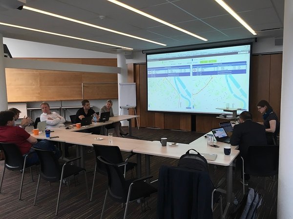
Remix is a platform that addresses all these points with impressive results. After seeing a hands-on real-life data demo at the Estonian Road Administration, our Mobility Product Manager, Marek Rannala, asked Mariano Maján and Keita Hill from Remix to shed some light onto how their platform has transformed public transport planning around the world.
Your clients use the platform in many cities and have been doing so for several years. What is the impact of Remix that you have noticed so far?
Mariano: Remix is a web-based planning platform that our users across the world are using. Basically, we try to make some of the very-old-school processes more efficient and faster. We have quite a few examples of the way Remix has changed things. Not the way bus networks are planned, because that is based on the same principles, which evolve over time but there hasn’t been a big change in them. I would say the biggest change is in being able to develop public transportation in a way that is more understandable for people.
What generally happens is that experts often know quite well what is best for the city but it is very hard to get acceptance from the people, and therefore you tend to just to listen to what some angry people say about changes to transport network. I think a good example is Tampere in Finland. The way that I've seen Remix changing a lot of their existing processes is how they've been able to interact a lot more with their citizens because Remix is web-based. They can show the principles of designing things in a way that they can be understood not only by transport planners but by a general citizen who is the end user of their transport system. By sharing their plans and being able to collect feedback from the public, they've been able to communicate a lot better with the citizens and get support for their plans. That has been the case in Tampere where they've gone through few rounds of feedback with the public, trying to incorporate ideas from public into their transport plan. That's something that we feel really proud of, when you hear them speaking about it: they explain that they've been really surprised about the feedback they've collected from the public. Generally, you would expect only bad things. And at the end you get a bit of everything: you get a bit of angry comments, you get a bit of good suggestions, and just the fact that having a visual tool for communicating and interacting with the public has been very useful. I would say that’s one of the biggest highlights that I've seen from all over the world.
We can relate to that. Positium helped design the new public transport network in Tartu last year and we also got angry comments and negative feedback. But feedback is a really important part of planning public transport.
Keita: As any good Bay Area startup does, we have a four-letter acronym for our corporate values: CHEF. It is somebody that is cooking up a great product for people. It's kind of a coded joke but the C is for collaboration, H is for humility, E is for empathy, F is for feedback. I think feedback is really one of the core things that we see internally in our processes but also in the product. If people can understand what the tradeoffs are between different route options, they can see the benefits of who would be served by a particular line. I think this is something that we've seen quite a few of our clients using.
Also, learning how to use Remix is in some way, learning how to be a transport planner that works in a data-driven way. The platform opens up that sort of thinking and people say: “let's look at the different possibilities, explore what the trade-offs are,” and it opens up planning to a much broader group of people that way. Which kind of relates back to our value of collaboration - trying to bring as many people into the process as possible so that the public transport networks in cities are things that the citizens believe that they own and are invested in.
You have included many different sets of data in Remix. You have also used mobile positioning data in Nordic countries. Have you used it anywhere else as well and what is your experience with this?
Mariano: If some of the readers are not familiar, we have travel patterns and origin-destination data that are the key component for how public transport planning is developed. Traditionally that has been done with surveys. There's also data that some of our customers can collect from ticketing systems.
In the last few months we had these big requests from many of our customers where they really wanted to interact with that data dynamically and for Remix this is something that was not possible a few months ago. And when we decided to start working on this, it was also because we knew that there's a lot of things happening on this space right now, like you guys [Positium] are working on. We've seen that most of our customers still rely on survey data or census data for information on how people travel.
But we've already seen that trend shift in the Nordics, in at least in Sweden, Norway and Finland, where our customers are purchasing mobile phone data to understand travel patterns better than they used to. I think it is very clear that this is the way forward. Doing surveys on the streets is a waste of resources and gives way less information than mobile phone data. We've also been asked by companies in Canada and in Australia about integrating their data with our platform which is something fairly easy. We're all about representing data on our platform and being able to get some analytics out of it while you're changing your transport network.
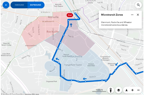
Keita: We've built our platform with the help of a former analyst at Apple Maps on our team who has brought a lot of experience in GIS. We've developed increasingly sophisticated layers to help planners view complex data in a simple way. And I think what is very helpful about the way that we're visualizing origin-destination pairs is that the data sets are huge. We often have millions of elements inside of them. But you can very quickly present them visually on the map. It helps people interact with the data in a very simple way. I think it unlocks these millions of rows of data in a way that helps you to apply that to real transportation decisions. So that is what we're excited about - taking something that's really complicated and big and making it relevant and small. I think that's something that we, with our data processing capabilities, aspire to do as a company.
Having this much experience over the years and about what is really happening in the field at the moment... What do you think - what can we expect in this field in mid-term future, 5 to 10 years?
Mariano: It's a very interesting question because it's a question that I guess we ask ourselves as a company every week. As a software company we work with public governments, providing them with software tools that help them to do their job better. And that job is changing a lot. The latest thing we've seen are all these e-scooter companies in the US and arriving in Europe this year [Bolt launched the first e-Scooter service in Tallinn in July 2019, after the interview]. We are seeing that in the micro mobility space there is a big need for planning and management tools, so we are already trying to help on that front.
The way I see the future is related
to not seeing different parts of the mobility space as independent. We see a
trend with most of our customers where they really want to plan and manage
transportation or mobility as a whole. That's kind of where we're heading as a
company, and that's also my personal belief. We started as a company that
worked on public transport, we still work on that, and I think it's a very
interesting space. In reality I don't see us working only on public transport
in five years. In five years, all our large and advanced customers are going to
need to see their data inside the planning and management of transportation.
It's not only going to be about: “Oh, how do we change this bus line, or should
we maybe extend this rail line here and build this crazy infrastructure
project.” I think that in 5 or 10 years it will be useless to only improve your
public transport network or to only improve your bike lane infrastructure. That
is not what I see in the future and I think the holistic approach is where we
are headed.
Keita: There's a visual in Remix that we turn on a circular buffer around each of the bus stops so that it shows a five-minute walking radius of that bus stop. And for the last hundred years planning public transportation has always been designed around that five-minute walking distance. I think what the new mobility solutions are offering completely unlocks and changes the way that public transportation works, instead of having to be constrained to that five minutes by walking you have five minutes by scooter or by electric bike. This means you can go maybe go three or four times as far. So instead of having to have every bus do these kind of spaghetti routes, trying to serve every little road, you can have an efficient route that is high frequency, high speed, and then have the micro mobility feeding into it. I think this completely changes the value proposition of public transport. What we're going to start to see is a transformation of services where instead of having five separate bus line corridors we might consolidate that to three, and as a result the frequency on all of those is going to almost double. It's going to be a more attractive offer. At the same time, we're going to see all the micro mobility feeding into the public transport so that the two work together.
The second implication is that there is a limited time frame where non-autonomous transportation network companies like Lyft and Uber are going to be able to continue the current business models to provide their services, because I think this combination of micro mobility and public transport is so powerful and much more convenient than even a ride sharing system that it will start to displace a lot of those trips at a much lower cost. I think the big question will be if the transformation to autonomous vehicle-based services will happen before we see the combo of public transport + micro mobility working together. And I think there is a big regulatory component to that, of who really wins the battle that is starting to unfold. I think it's a really exciting space from a city building and quality of life perspective for those of us that do live in cities.
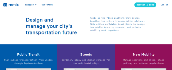
Remix provides its clients with a platform to manage and design transportation systems in cities. The digital platform allows to display layers upon layers of data in a simple and engaging way. Public transport planning organisations can use this platform to successfully communicate new ideas to the public, get feedback and create sustainable public transportation networks.
Mariano Maján is the Director of Remix’s European branch. He is originally from Spain and has worked with mobility for 8 years.
Keita Hill is a Project Manager at Remix. Keita is a Canadian but living in Amsterdam, currently working with 15 public transport authorities across Europe.
.png)


